DoD’s technology innovation office seeking bids from U.S. commercial remote sensing vendors

WASHINGTON — The Pentagon’s technology arm, the Defense Innovation Unit, is soliciting bids from U.S. companies that operate commercial remote sensing satellites and can provide both imagery and data analytic services.
DIU on Jan. 13 released a solicitation seeking proposals from U.S. operators of small satellite constellations capable of observing the Earth’s surface in day, night and adverse atmospheric conditions. The project, called “Peacetime Indications and Warning,” is an effort to supplement the military’s own remote sensing capabilities with commercial products.
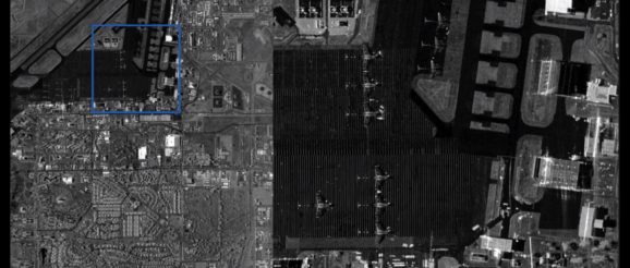
Remote sensing technology of interest includes synthetic aperture radar (SAR), hyperspectral imaging, electro-optical imaging, infrared imaging and radio frequency (RF) sensing.
Proposals, which DIU calls “solution briefs,” are due Jan. 26.
A DIU spokesperson said in a statement to SpaceNews that DoD has a “critical need for improved, large scale, situational awareness satisfied by less expensive, day-night, all-weather imaging satellites capable of filling gaps in space-based reconnaissance.”
DoD would leverage low cost, commercial radar-imaging satellites, for example, for early indications and warning during peacetime and to conduct patterns of life analysis, the spokesperson said. “Warfighters and decision makers mutually benefit from timely and accurate alerts that increase situational awareness and improves decision making.”
DIU will consider pitches from commercial satellite manufacturers offering hardware to develop a remote sensing constellation and also from providers of end-to-end remote sensing services. The solicitation also asks for advanced analytics software to help develop machine learning algorithms for object detection. DoD would want to see a demonstration of reduced latency direct downlink of data and imagery to tactical ground terminal for data processing in the field.
“The size and cost of individual satellite technology should provide the greatest flexibility for launch and replacement,” the solicitation says. “Resulting imagery must be in a format compatible with ingestion into a cloud-based computing architecture for subsequent machine learning.”
Imagery and data will be collected during an 18-month pilot program and will be made accessible for use as training data sets to support the development of artificial intelligence algorithms.
