UK drones conduct first ever fixed-wing radiation mapping of Chernobyl | Emerging tech & innovation | Techworld

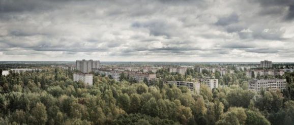
On 25 April, 1986, the world’s worst nuclear disaster struck in northern Ukraine. A steam explosion in the Chernobyl nuclear power plant caused a fire that released a plume of radioactive material, which the wind carried around Europe. The worst damage was done to the Red Forest surrounding the complex, which earned its name from the colour that the pine trees turned when they died after absorbing high levels of radiation. Thirty-three years later, the Red Forest remains one of the most contaminated areas in the world.
In the rush to clean up the 2,600 km2 exclusion zone, unlined, leaky trenches were quickly dug and filled with tractors, fire engines, cranes and other wreckage from the fallout, leaving enormous “waste graveyards”. The hasty operations left little time to accurately record what was buried, some of which is still leaking radioactive material in the surrounding grounds and rivers.
At the time of the disaster, the respondents relied on men on the ground with radiation detectors in their hands covered by helicopters overhead dropping water on the flames, a time-consuming process that exposed many people to a high dose of radiation.
Today, the emergence of sophisticated drones and radioactive monitoring has created a safer, more efficient method. The leading experts in this robotics technology are based in the UK’s National Centre for Nuclear Robotics (NCNR), whose work attracted the attention of the Ukrainian government. They asked the research group to map the area, in order to understand what was buried in the trenches and characterise the distribution of radioactivity so they could clean up the damage and find new uses for the land.
“Part of the reason that had never done before is because the technologies of radiation mapping didn’t exist until we build the stuff this year,” said Professor Tom Scott, a co-director of the NCNR based the University of Bristol.
His team packed up around £250,000 of drones and lightweight gamma spectrometers that detect radiation and set off for Ukraine. On arrival at their base near the Red Forest, they first sent a small, disposal reconnaissance zone that would be sent out first to check the height of trees. Once it confirmed a safe flight path, a fleet of fixed wing “Titan” drones, which could fly long distances and cover larger areas, were sent several kilometres into the zone to conduct a survey and then fly back.
When they found something interesting, multi-rotor aircraft that fly low and slow were sent to map the radiation more closely. They could also land on the ground to provide a better spatial resolution of the area.
The team used a novel radiation mapping technology to get a very high sensitivity of radiation in real-time, which allowed them to provide their colleagues in the field or back in the UK with instant information. This could play a crucial role in a future nuclear incident, as respondents could receive data quickly and make rapid decisions.
In total, they covered a 15km2 area of the Red Forest, mapping radiation at altitudes of 45-50m. The project was the largest ever fixed-wing radiation mapping survey conducted, and the first ever fixed-wing survey over Chernobyl.
“In each individual flight by one of these fixed wings, we were flying up to 60km length flights, typically in looping patterns which overlapped, and then bringing it back to a safe landing position and at relatively low altitudes,” said Scott.
“If you’re flying a manned aircraft, your bottom altitude level for safe flying is about 120 metres. Below that’s considered too low to be safe, because you might hit something. With drones you can go much lower, therefore you get higher sensitivity and resolution of your data.”
New discoveries at Chernobyl
The team returned to map another area of the Exclusion Zone: the ghost town of Kopachi, an abandoned village near Chernobyl where all the houses other than a kindergarten and one other brick building had been torn down and buried.
A Titan was sent out to map the area, where it found a previously undiscovered hotspot. The multi-rotors were then sent in for a closer look at the structure.
What it had found was a mechanical waste separation facility, where contaminated soil and rubble had been brought for analysis. In the process, the facility became very heavily contaminated.
The NCNR team used the gamma spectrometers to find evidence of radiation and then sent people in to quickly confirm the results, before the high doses of radiation could cause them irreparable harm.
Findings like this could have a range of benefits. Ukraine wants to use them to create a safe tourist industry and to establish large solar farms in the fallout zone, as although the land can’t be used to grow crops, it can generate power, and the old nuclear power plant means all the electricity infrastructure is already there.
The technology could also have benefits in the UK. It could be used to clean up nuclear accidents, for targeted surveying of nuclear waste facilities, routine monitoring of storage sites, emergency responses to dirty bomb attacks, and for finding rare earth minerals.
“Therefore we can use exactly the same technology, instead of responding to a nuclear incident, to go and find yourself, literally, a gold mine,” said Scott.
