Civic Innovation Fellows: Mapping for Equity on OSM – Spring 2023 Project
Our talented ninth cohort of Civic Innovation Fellows are back and working hard on their Spring project, Mapping for Equity on OpenStreetMap (OSM), which we’re really excited about.
The project is centered around mapping public amenities, from public bathrooms to wheelchair accessible play equipment to benches, with a focus on creating more equitable public spaces. We’re so lucky to partner with North Brooklyn Parks Alliance and Council Member Jennifer Gutiérrez’s District 34 office on this project to achieve our ultimate goal of building a comprehensive public space data playbook that empowers community organizations & individuals to collect, verify, and analyze public realm data. Fellows are mapping on OpenStreetMap, an open data platform for us to place community data. OSM is community-run but is used by individuals, volunteers, companies, nonprofits, governments, organizations, and more all over the world.
Here’s how we prepared:
First, we’ve identified the focus areas to map. As the saying goes, the squeaky wheel gets the grease. A notable trend can be found on OpenStreetMap that affluent areas are mapped with more significant detail than low-income areas. This points to a bias in interest areas and under-mapped areas can become underrepresented areas. Without a foundation of what amenities are present, how many, and how many do there need to be? – it’s nearly impossible to make a data-driven appeal.
Alongside creating the list of areas, we narrowed down a list of amenities to map. To map for equity, we want to map amenities that center people that aren’t always accommodated. Our list of amenities consider people with various mobile abilities, ages, and living situations. Here are just a few of the objects on our list to map:
- Parks
- Playgrounds
- Play Structures (their accessibility, various types)
- All public seating infrastructure
- Benches (their functionality, material, size, and number of seats)
- Ramps, crosswalks, curb cuts, walkways (their material and accessibility), sidewalks (and their accessibility), stairs (presence of handrails)
- Bicycle parking
Here’s what’s been done so far:
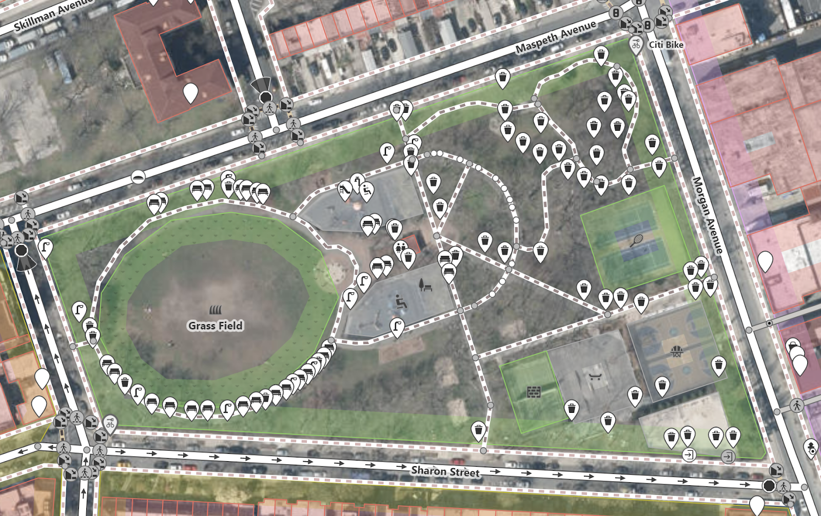
Fellows have already mapped over 130 amenities covering 24,850 square feet just within their first two days of mapping. With the huge help and support of the OSM community members, fellows respond to online community members’ feedback to ensure that when amenities are added to OSM, they have the appropriate tags and details. THANK YOU OSM Mappers!!
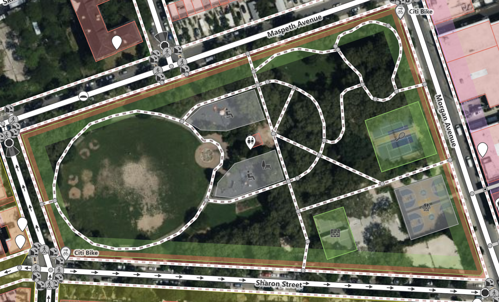
This is what Cooper Park looked like on OSM before the fellows started mapping and after:
It’s been such a pleasure to see fellows grow into civic-motivated mappers and collaborate with each other, with the OSM community, to provide analyses to local stakeholders who want to see North Brooklyn be accessible to everyone.
Here’s what we’re looking forward to:
- There will be additional OSM public events we’re hosting later on in the year! Check our slack or subscribe to our newsletter for updates.
- Finalizing analyses to share back with North Brooklyn Parks Alliance and CD 34 on where more equitable amenities can be placed for future developments
- Sharing a final toolkit with the public to replicate these efforts across New York.
Our fellows have been relentless in their mapping efforts for equity thus far and we can’t wait to share the next installment of progress!
The post Civic Innovation Fellows: Mapping for Equity on OSM – Spring 2023 Project first appeared on BetaNYC.